


A Team of Experts
20+ Year Experience
Verified Hotels
Three Decades Crafting Unforgettable Wildlife Safari Adventures
Masters of Tiger Safari Excellence in India Tours
With over 30 years of expertise in wildlife safari experiences and a specialization in tiger safari tours in India, India Classic Journeys assures you a comprehensive safari adventure on your upcoming Tiger Safari India expedition.
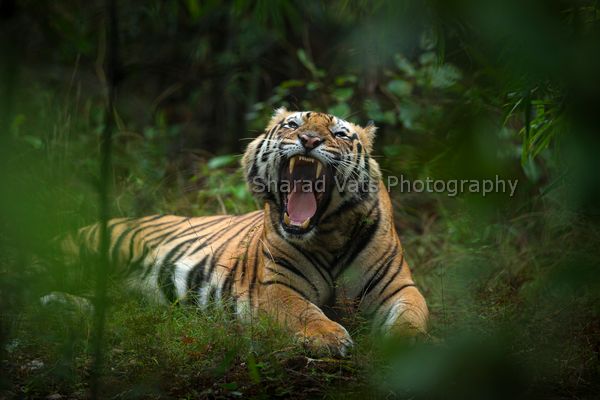
Encompassing a variety of species and diverse landscapes within some of the country’s premier national parks for wildlife enthusiasts, such as Ranthambore National Park, Corbett National Park, and Bandhavgarh National Park, our tiger safari tours highlight the richness of Indian wildlife coupled with glimpses of cultural and heritage experiences. Discover our top tiger safari India tours right here.
Explore Top Categories
Best Wildlife and Culture Tours in India
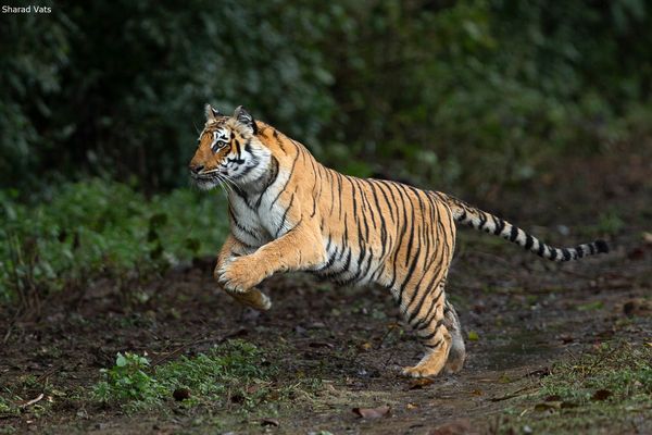
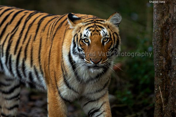
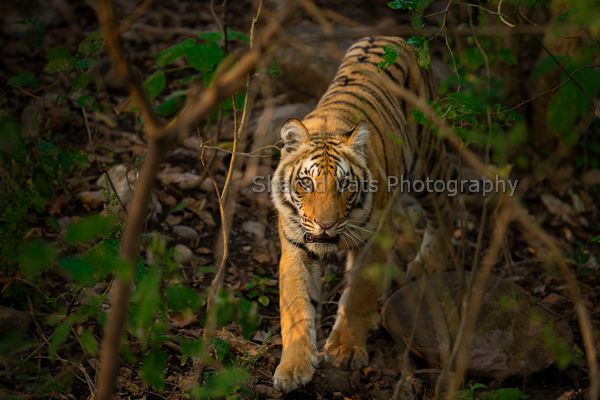
India, renowned for its remarkable biodiversity, showcases a diverse array of wildlife thriving across its varied landscapes. From the majestic tigers of Rajasthan to the regal male tigers of Kanha National Park, and from the historic forts of Bandhavgarh to the Himalayan foothills in Corbett National Park, India embraces a myriad of wildlife. Our top-rated India Classic Journeys seamlessly integrate renowned national parks, each brimming with abundant wildlife. A tiger safari in India demands not only patience and perseverance but also the guidance of an experienced team – precisely where we excel.
Our carefully curated fact files provide comprehensive details, addressing all your inquiries about a tiger safari in India. Highlighted below are some of our guests’ favorite tiger safari tours in India. The Just Tigers Tour, for instance, covers the top three national parks in central India – Bandhavgarh Tiger Reserve, Kanha National Park, and Pench Tiger Reserve. The synergy between Kanha and Pench beautifully narrates the tale reminiscent of the Indian Jungle Book.
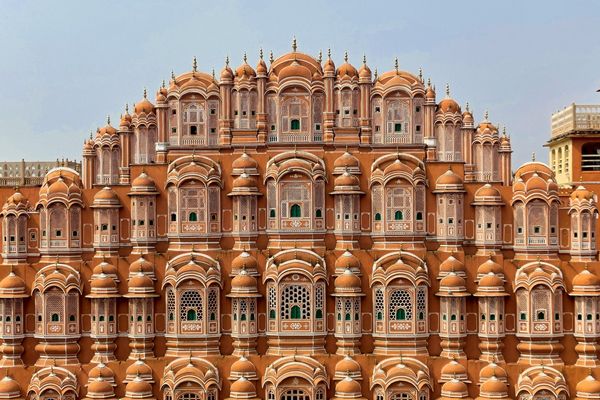
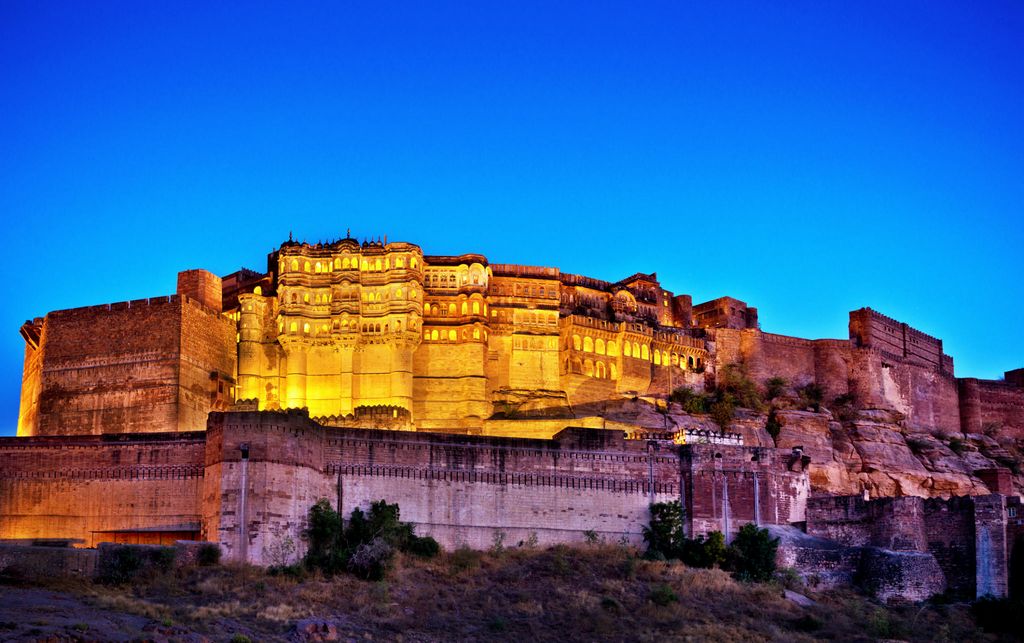
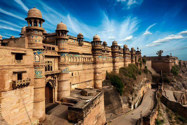
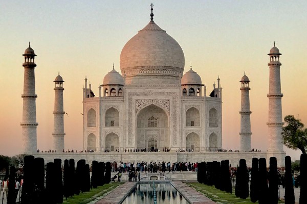
Bandhavgarh National Park/Tiger Reserve not only unfolds its historical significance in Indian wildlife and heritage but also captivates with the Bandhavgarh fort and breathtaking wildlife. Other popular tiger safaris in India, such as the Tigers and Indian Heritage tours, blend wildlife excursions in national parks and tiger reserves like Ranthambore National Park and Corbett National Park with glimpses of Indian culture and history. This includes visits to iconic landmarks such as the Taj Mahal, the Khajuraho temples, and the vibrant markets of Jaipur and New Delhi.
In addition to these wildlife adventures, our India Classic Journeys extend beyond nature safaris, encompassing cultural and spiritual tours. Explore the diverse cultural landscape of India, immersing yourself in the spiritual essence of the country. Whether it’s a visit to ancient temples, historical monuments, or the bustling bazaars, our journeys promise a holistic experience that goes beyond the thrill of a tiger safari, providing a profound connection with India’s rich heritage.
India Classic Journeys
★★★★★ 5/5
Embark on a transcendent journey through India’s cultural tapestry, from the vibrant chaos of New Delhi to the tranquility of Dharmasha.
India Classic Journeys
★★★★★ 5/5
Embark on a classic journey through incredible India, where the Taj Mahal’s grandeur, encounters with tigers, serene Ganges boat rides.
India Classic Journeys
★★★★★ 5/5
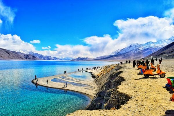
Embark on an unforgettable journey through Ladakh, where rugged landscapes and ancient monasteries await.
India Classic Journeys
★★★★★ 5/5
Embark on a captivating wildlife odyssey with the Bandhavgarh, Kanha, and Pench Tour in India. Explore lush jungles of Bandhavgarh.
India Classic Journeys
★★★★★ 5/5
Embark on a thrilling Big Cat Tour in India, a riveting adventure through renowned national parks like Ranthambore and Bandipur.
India Classic Journeys
★★★★★ 5/5
Embark on a captivating journey with our “Just Tigers & Taj Mahal” tour package. Witness the raw beauty of Bengal tigers in Ranthambore.
Trusted Partners :A Showcase Of Collaborations

Explore India's Rich Heritage and Thrilling Tiger Safaris with Us
More Reasons to Choose India classic journeys
India Classic Journeys, where the vibrant wilderness springs to life, offering unforgettable adventures. Boasting over three decades of expertise and an enduring enthusiasm for tigers, wildlife, cultural, and spiritual tours, we stand distinguished as one of India’s most reliable wildlife and tour operators.
India Classic Journeys excels in curating exceptional wildlife encounters, intricately designed to envelop you in the enchanting splendor of India’s varied ecosystems. Our adept and seasoned naturalists are committed to guaranteeing that each instance of your wildlife expedition is brimming with awe and exploration. Additionally, we extend our expertise to include cultural and spiritual tours, enhancing your journey with a rich tapestry of India’s diverse heritage. Immerse yourself in the mesmerizing beauty of our nation, where every moment is a discovery and every step a revelation, as you embark on unforgettable adventures with India Classic Journeys.
Indulge in the splendor of our thoughtfully curated wildlife lodges and accommodations, meticulously selected to offer unparalleled comfort and a harmonious connection with nature. Whether it’s opulent jungle retreats or sustainable wilderness camps, we guarantee a captivating and revitalizing stay. Explore our diverse array of cultural and spiritual tours, enriching your journey with unique experiences. Embark on India Classic Journeys, where every moment is a seamless blend of luxury and natural beauty.
At the core of our service lies the commitment to seamless transport, recognizing that reaching the heart of the wilderness is the initial stride toward an unforgettable wildlife encounter. Our skilled drivers and meticulously cared-for vehicles guarantee a secure and pleasant expedition, enabling you to immerse yourself in the awe-inspiring scenery throughout the voyage. Expand your horizons with our cultural and spiritual tours, elevating your India Classic Journeys experience.
India Classic Journeys has garnered praise and gratitude from numerous global visitors. Our dedication to providing outstanding wildlife experiences has positioned us as the top choice for wildlife enthusiasts, experts, and photographers eager for exciting encounters with India’s majestic Bengal Tigers and other fascinating creatures. Additionally, we offer cultural and spiritual tours, ensuring a holistic exploration of India’s diverse wonders.
India Classic Journeys is distinguished for its proficiency in orchestrating safaris to encounter majestic wildlife like leopards, snow leopards, Asiatic lions, red pandas, and sloth bears. Whether you yearn to witness Ranthambore’s majestic tigers, Ladakh’s elusive snow leopards, or Gir’s regal Asiatic lions, our thoughtfully crafted itineraries immerse you in the heart of these remarkable habitats. Additionally, explore cultural and spiritual tours, ensuring a holistic Indian experience.
GET A FREE QUOTE
Feel free to get in touch with our team of wildlife experts and receive a free quote for your next tiger safari holiday! You could also use this channel to request for a custom wildlife holiday package in India!
Discover the Treasures of Our Featured Wildlife and Culture Destinations in India
Frequently Asked Questions
What are the must-visit cultural destinations in India during a wildlife and culture tour in India
ome of the must-visit cultural destinations in India during your cultural and wildlife tour include the Taj Mahal in Agra, Jaipur’s palaces and forts, Varanasi’s spiritual sites, and the cultural heritage of cities like Delhi and Udaipur. For wildlife enthusiasts, national parks like Ranthambore, Kaziranga, and Jim Corbett offer incredible biodiversity.
Which historical sites should I visit in India?
India is a treasure trove of history. Marvel at the Taj Mahal in Agra, explore the ancient ruins of Hampi, or visit the historic Red Fort in Delhi for a glimpse into India’s rich past.
Are cultural and wildlife tours in India suitable for families and children?
Yes, cultural and wildlife tours in India can be family-friendly. Many tour operators offer family-oriented itineraries that include educational activities and interactions with local communities. However, it’s essential to consider the age and interests of your children and choose destinations and activities accordingly.
What are some of the popular wildlife species to spot during wildlife and culture tour in India?
India boasts incredible wildlife diversity. During wildlife tours, you can spot iconic species like Bengal tigers, Indian elephants, Indian rhinoceroses, leopards, and various bird species. Each national park and region has its unique fauna and flora, making India a wildlife enthusiast’s paradise.
What should I pack for a wildlife and culture tour in India ?
Packing essentials for a cultural and wildlife tour in India include comfortable clothing suitable for the season and region you’re visiting, sturdy walking shoes, insect repellent, sunscreen, a hat, a reusable water bottle, a camera with extra batteries, any necessary medications, and a power bank for charging electronic devices. Additionally, it’s wise to check specific packing recommendations with your tour operator based on your itinerary.
What traditional tours are available in India?
Experience the soul of India through traditional tours. Sail through the backwaters of Kerala on a houseboat, attend a traditional Rajasthani folk festival in Jodhpur, or participate in a traditional cooking class to savor the authentic flavor
When is the best time to embark on a wildlife and culture tour in India ?
The ideal time for a cultural and wildlife tour in India depends on your preferences and the regions you plan to explore. Generally, the winter months (October to March) offer pleasant weather for most parts of India. However, wildlife enthusiasts may prefer visiting national parks during the cooler months, while cultural tours can be enjoyed year-round.
What national parks can I explore in India?
India boasts a diverse range of national parks. Experience the thrill of wildlife at Jim Corbett, witness the majestic Bengal tigers at Ranthambore, or discover the unique biodiversity of Periyar in Kerala.
What cultural tours are popular in India?
Immerse yourself in India’s rich heritage with cultural tours. Explore the vibrant markets of Jaipur, witness traditional dance forms like Kathak in Varanasi, or take part in a yoga retreat in Rishikesh for an authentic cultural experience.
How can I plan a custom tour combining these experiences?
Tailor your trip to include a mix of national parks, cultural experiences, and historical sites based on your preferences. Consult with a local travel expert to create a personalized and unforgettable journey through India.